Photos
|
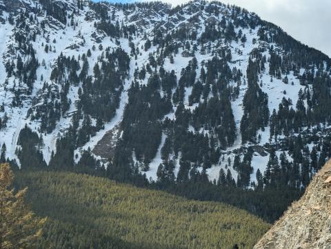
Northern Madison, 2025-03-26 In Gallatin Canyon we saw some wet slides in the chutes/gullies south of Lava Lake. Photo: USFS Snow Rangers Link to Avalanche Details |
|
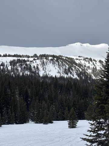
Cooke City, 2025-03-26 Today we noticed these natural small wind slabs on Mt Henderson. Photo: J Mundt Link to Avalanche Details |
|
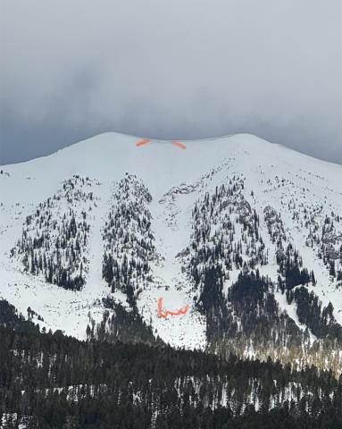
Bridger Range, 2025-03-25 Noticed crown and debris on drive up Bridger Canyon this morning. Looks like a wind slab. Photo: Peter H Link to Avalanche Details |

|
, 2025-03-25 Understanding Avalanche Safety Preparedness – 5-Minute Survey for Motorized Users We need your input! Eastern Oregon University is conducting a survey to better understand avalanche safety preparedness among motorized backcountry users like you. Your feedback will help us learn more about who is purchasing and practicing with avalanche rescue gear (beacon, probe, shovel) and participating in avalanche education—and why some riders aren’t. The survey is confidential and anonymous. Your feedback is invaluable in improving avalanche education and awareness. Please take a moment to share your experience and help us make a difference. https://eoustmhs.qualtrics.com/jfe/form/SV_3L8QKAuZzcxJBLo Thank you for your time and for being a part of this important effort! |
|
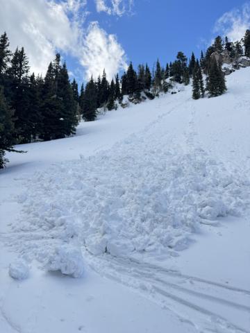
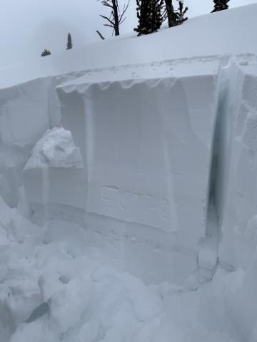
Bridger Range, 2025-03-25 We skied past a wet loose avalanche that came off of the south face of Bradley‘s Meadow. It was slightly bigger than the rest of the wet snow activity that I observed during the day. Photo: GNFAC Link to Avalanche Details |
|
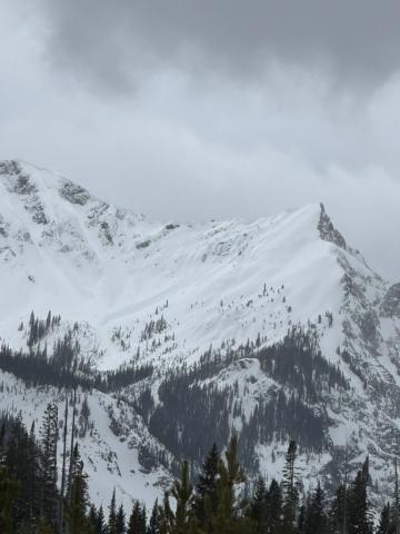
Cooke City, 2025-03-24 As we rode, we dug a few snowpits looking for the weak layer that we found yesterday buried about 2 feet deep. While we were able to find this layer, we only got propagation in one of three tests (ECTP 26, E aspect, 9070'). Photo: GNFAC |
|
Cooke City, 2025-03-24 We noted one avalanche on the Fin that likely occurred yesterday or early this morning from a wind slab or cornice fall. Photo: GNFAC Link to Avalanche Details |

|
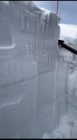
Cooke City, 2025-03-23 Photo of a recent natural avalanche north of Cooke City, observed today (3/23/25). A S, SE aspect in Sheep Creek at about 9000'. Photo: B Fredlund Link to Avalanche Details |
|
Out of Advisory Area, 2025-03-23 We got an ECTP18 result on a north aspect at 8600’ in the absarokas. It propagated on a small layer of facets 30cm down. Photo: C von Avis |

|
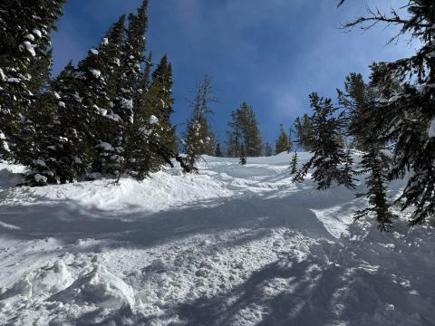
Northern Madison, 2025-03-23 On Mar 22 There was a small wind slab avalanche in McAtee (Photo) and a small wind slab in Beaver Creek. Photo: GNFAC Link to Avalanche Details |
|
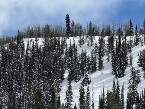
Southern Madison, 2025-03-22 Snowmobile triggered slide in Taylor Fork today from above cutting across. Nobody caught. 2.5 feet deep 150 feet wide Link to Avalanche Details |
|
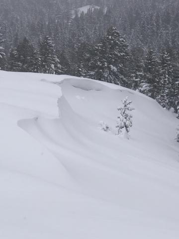
Southern Madison, 2025-03-22 Snowmobile triggered slide in Taylor Fork today from above cutting across. Nobody caught. 2.5 feet deep 150 feet wide Link to Avalanche Details |
|
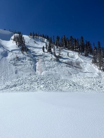
Island Park, 2025-03-20 All elevations in Island Park experienced heavy snowfall combined with high winds,this made for unstable wind slabs and cornices. Photo: K Allred |
|
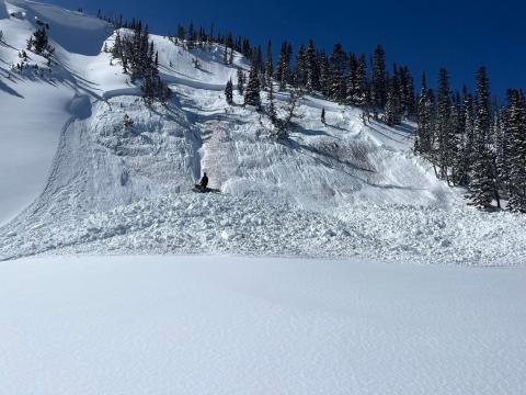
Southern Madison, 2025-03-19 Persistent slab avalanche from (3/19) in Sunlight Basin, Taylor Fork. Photo: Anonymous Link to Avalanche Details |
|
Southern Madison, 2025-03-19 Persistent slab avalanche from (3/19) in Sunlight Basin, Taylor Fork. Photo: Anonymous Link to Avalanche Details |
|
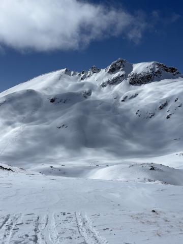
Cooke City, 2025-03-19 Today we saw a D2 slab avalanche at Goose Lake, E facing, 10800 ft. We estimate this avalanche to have ran in the early hours of 3/17. Photo: BPG Link to Avalanche Details |
|
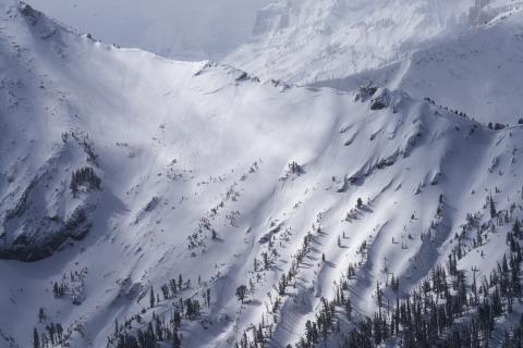
Cooke City, 2025-03-19 No fresh avalanche activity observed. Attached is a photo of the only sign of a recent avalanche we could find. (an old crown on an East aspect at 9600'). Photo: B Fredlund Link to Avalanche Details |
|
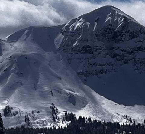
Cooke City, 2025-03-19 Avalanche on the SE face of Scotch Bonnet in Tragenic Bowl and one on the NE face of Wolverine. They both broke 2-4’ deep. The avalanche on Wolverine slide aprx 1500’. Both were in wind loaded areas at upper elevations. Photo: BPG Link to Avalanche Details |
|
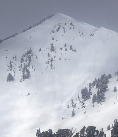
, 2025-03-19 Avalanche on the SE face of Scotch Bonnet in Tragenic Bowl and one on the NE face of Wolverine. They both broke 2-4’ deep. The avalanche on Wolverine slide aprx 1500’. Both were in wind loaded areas at upper elevations. Photo: BPG Link to Avalanche Details |

|
Island Park, 2025-03-18 We saw a handful of avalanches above treeline terrain that seemed to be wind slabs. However wind and snow had obscured them and I suspect there had been a lot more.
|
